

Google posts satellite images of post-quake Christchurch
High resolution images show the devastation from above. [PHOTOS]
High resolution images show the devastation from above. [PHOTOS]
Google's satellite imaging partner, GeoEye, has taken new pictures of Christchurch, putting a new perspective on the damage caused by the Tuesday, February 22 earthquake.
The satellite photos were taken on Thursday, February 24th from the GeoEye-1 satellite.
Some parts of the city are covered in clouds, but substantial portions of the central business district are clearly visible.
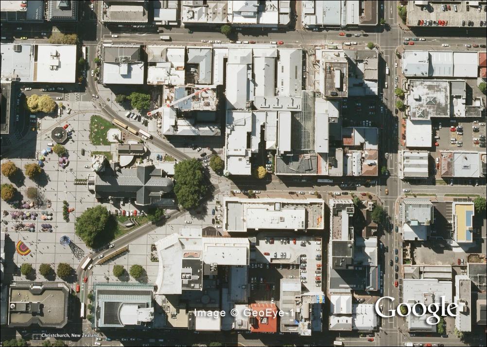
Christchurch Cathedral, March 2009 (click to zoom).
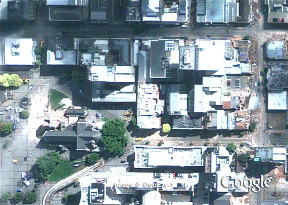
Christchurch Cathedral, 24 February 2011 (click to zoom).
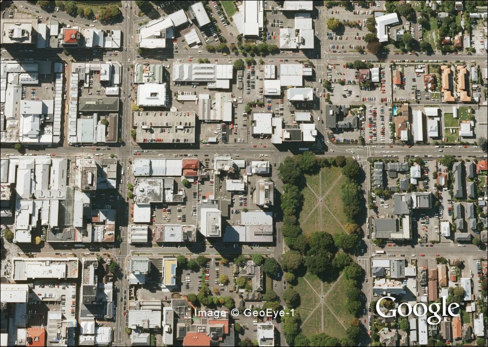
Latimer Square, March 2009 (click to zoom).
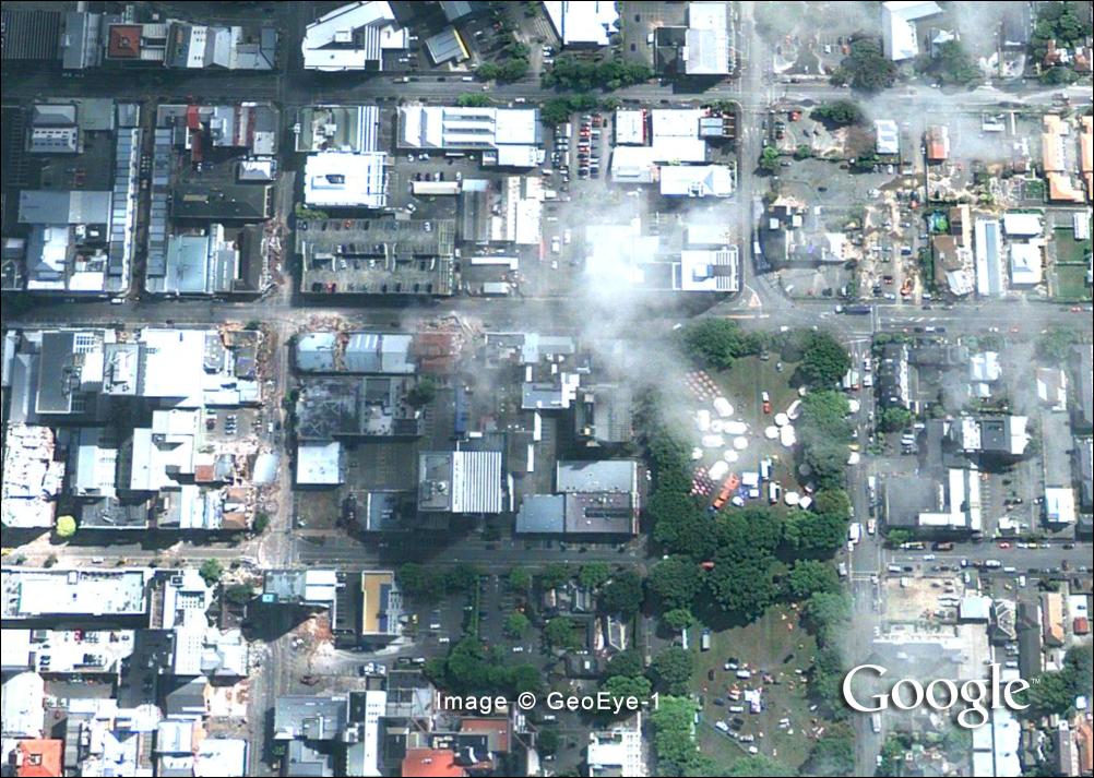
Latimer Square, 24 February 2011 (click to zoom).
Pre and post-quake images
The Google Earth programme (here) must be installed on your computer for you to load the Christchurch photo KML files in the links below (once installed, use the layer on/off function to compare pre and post-quake photos. The pre-quake images were taken in March 2009).
Google has also posted an online album of post-quake satellite images, which can be viewed here.
Google Earth Christchurch photo files
You must have Google Earth installed to view these photos.
Right-click on each link; choose Save As to save the file to your your computer, then open the file to view in Google Earth.
File 1: Central and Northern Christchurch
File 2: Southern Christchurch:
Separately, Google has posted new satellite images of riot-hit Libya. Again, Google Earth is required:
File 1: Central Tripoli
File 2: Eastern Tripoli:
Sign up to get the latest stories and insights delivered to your inbox – free, every day.